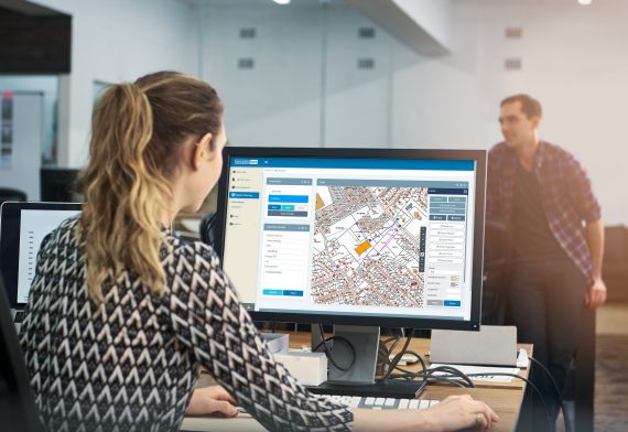
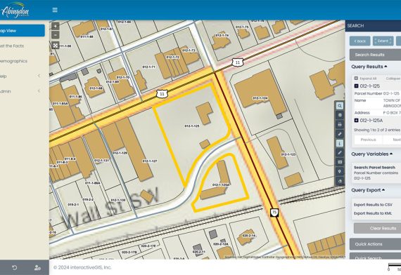
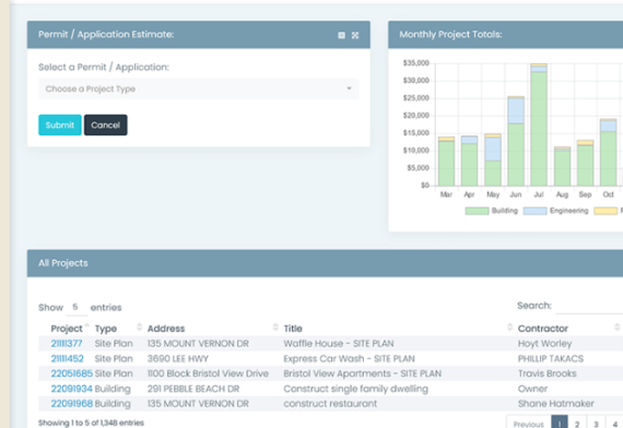
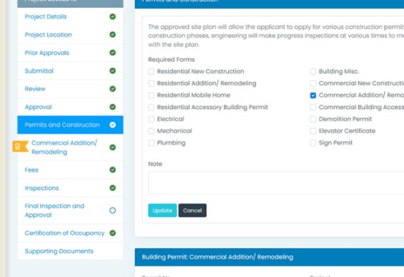
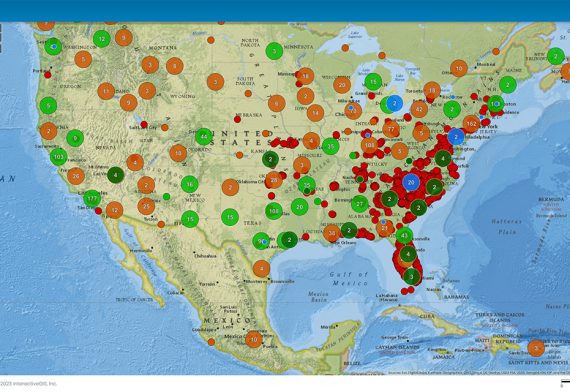
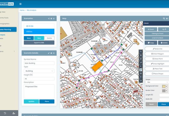
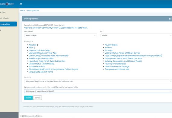
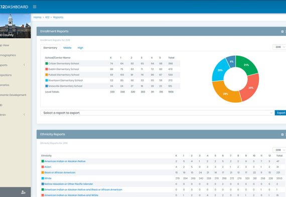
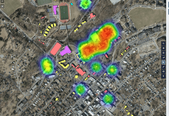
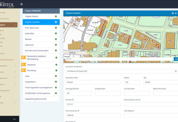
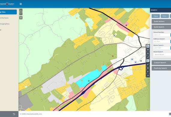
loader-logo

8 Essential
Web GIS Features
You Didn't Know
Existed

Map Your Way to a Better GIS

A web GIS where you can make a difference.

Be known for your dependable online maps & data

We don’t just care about providing you with the best worry-free web-based GIS, we care about you and freeing up your day so that you can accomplish more.

96% of our customers have been with us for more than five years
On average, we save our customers 57.2% of the typical startup cost; These include setup, deployment, and training costs
When compared to others in web-based GIS market, on average, we save our customers 58.3% of annual hosting and maintenance costs
By listening to our customers we have incorporated many new features thereby increasing functionality, productivity, and user satisfaction
client-image

Deliver Your Best Data

Save Time & Money

Provide More Services

Intuitive Web
GIS Interface

Meaningful Web GIS
Functionality

Hassle Free
Web GIS Hosting

The day’s too short for you to worry
about your web-based GIS

Do you wish you had more time to devote to maintaining your GIS data? We believe the integrity and accuracy of your GIS data deserve your full attention, and now, with minimal involvement, you can easily and confidently make it web-accessible it to those who need it.

The day’s too short for you to worry about your web-based GIS

It can be a daunting task to keep up with the demands of an ever-evolving technological landscape. However, by investing in modern web GIS solutions, organizations can streamline their processes, reduce costs, and increase efficiency, all while delivering better services to their users. Furthermore, embracing innovative technologies can help position local governments as forward-thinking leaders, attracting new businesses and residents to their area and fostering a culture of innovation and progress.

No need to worry about web gis

Overwhelmed by Ongoing Web GIS Innovations and the Demand for Reliable Data?

We get it. The fast-paced evolution of technology, especially in the GIS landscape, can feel overpowering. At InteractiveGIS, Inc., we not only understand the pressures and challenges you navigate daily but also empathize with the need to stay ahead, remain accurate, and be innovative.


Your Challenges, Our Mission

    • Keeping up with technological advancements
    • Delivering up-to-date and accurate GIS data & maps
    • Balancing innovation with functionality and cost-effectiveness
No need to worry about web gis

We are well aware of the aspiration to provide exceptional functionality to your users and the stress that comes with managing such delicate balances.

We’re More Than a Service Provider—We’re Your Partner

Our expert team shares your passion for overcoming challenges and achieving goals. We are:

    • Committed to progress and innovation
    • Dedicated to ensuring you have the support and resources to succeed
    • Eager to offer solutions that are user-friendly, reliable, and uniquely tailored

Listening and Understanding

We actively tune into your concerns, challenges, and ambitions. By delving deep into the nuances of your issues, we provide tailored and impactful solutions, ensuring the longevity and sustainability of our partnership.

Unraveling Complexities Together

Our goal is to help you unlock the full potential of your web-based GIS, allowing you to:

    • Provide better services to your users
    • Streamline your processes
    • Reduce costs and increase efficiency

All while you focus on what matters most to you.

A Partnership for Mutual Growth

At InteractiveGIS, Inc., we offer more than online mapping solutions—we offer a partnership marked by mutual growth, understanding, and a shared vision. We stand by you, helping you navigate challenges and uncover the untapped potentials of web-based GIS solutions. Together, we can build a future marked by progress, innovation, and shared success.

Let’s navigate the intricate world of GIS technology together, focusing on mutual growth and progressive innovation! Contact Us today and let’s start this journey together.

How it Works

Three steps to a worry-free GIS experience: Consult, Create, Launch.
Schedule a meeting to discuss your web GIS

Schedule a Meeting

Let's take the first step towards enhancing your online mapping services! Schedule an online meeting with us so that we can discuss your requirements and identify the problems that you need to solve. During the meeting, we'll work together to understand the data, maps, and functionality that you want to include in your site and then you explore if iGIS® is the right fit for your online GIS needs.

Experience your site with a free trial

Experience Your Site

If you decide to move forward with a free trial, we'll provide you with a secure folder to upload your GIS data. Our open-source based platform is designed to handle any GIS data format with ease. Once your site is ready, we'll provide you with onboarding tips and access so that you can showcase it to your organization and see the value it brings.

Set a rollout date for your new web GIS.

Rollout

If your organization decides to engage with our team, we'll prepare a comprehensive quote that includes all the ideas and functionality we discussed during the discovery process. Once the quote is approved, we can set a rollout date and get started on creating a powerful and efficient web GIS that meets all your online mapping requirements.

Elevate Your GIS Game!
Tired of explaining your web GIS limitations and spending endless hours on seemingly simple requests?

Imagine a world where your web GIS meets all demands effortlessly, freeing you to focus on innovation and accurate data creation. Transform those requests into real-time web GIS functionality. Sounds refreshing, doesn’t it?

Avoid the Pitfalls of Outdated Web GIS Technology:
In the dynamic and demanding environment of city and county management, utilizing outdated web GIS solutions can lead to significant drawbacks:

    • Operational Setbacks: Inefficient response times and hindered task execution can hamper municipal progress and efficacy.
    • Diminished Service Quality: Falling behind in technology may lead to reduced service levels for the residents.
    • Strained Budgets: Managing and maintaining outdated systems can lead to unnecessary financial strains.

At InteractiveGIS, Inc., we understand the unique challenges faced by city, town, and county employees and are committed to helping you overcome them. Don’t let technological limitations dictate your municipality’s capabilities. Opt for advancement, opt for efficiency, opt for InteractiveGIS, Inc.

Connect with Us!
Dive into state-of-the-art web GIS solutions and turn your imagination into reality!

8 Essential Web GIS Features You Didn’t Know Existed!
Map Your Way to a Better GIS

What our Customers are Saying

We don’t just care about providing you with the best worry-free web-based GIS, we care about you and freeing up your day so that you can accomplish more.

96% of our customers have been with us for five or more years
On average, we save our customers 57.2% of the typical startup cost and 58.3% of annual web GIS hosting and maintenance costs
We’ve listened to our customers and have added their ideas to the web-based GIS; much of their input has helped to increase its functionality, productivity, and user satisfaction

What our Customers are Saying

Unlock the Future with InteractiveGIS, Inc.:
Partner with us and unlock a realm of possibilities, witnessing firsthand the evolution of your organization’s operational capabilities, decision-making processes, and service delivery. Our integrated web GIS solutions enable informed, timely decisions, ensuring optimal outcomes for both the organization and the community it serves. With the continuous exploration of new horizons in GIS technology, we propel organizations to the forefront of their sectors and open the door to groundbreaking innovations. The efficiency of our web GIS solutions optimizes workflow, reduces operational costs, and allows organizations to allocate resources more effectively, fostering overall organizational productivity and growth.

Our commitment to mutual growth ensures the enduring success of our partners. The benefits of aligning with InteractiveGIS, Inc. extend beyond immediate advancements, laying the foundation for sustained development and continual refinement of geospatial strategies. We provide unwavering support and adaptive solutions that evolve in tandem with your organization’s changing needs and the ever-progressing technological landscape, ensuring enhanced services and positive community impacts. As leaders in web GIS technology, we ensure that your organization is consistently at the cutting edge, shaping the future of geospatial applications and setting industry standards.

Start your journey with InteractiveGIS, Inc. and co-create a future where your vision merges with cutting-edge technology to forge a path of lasting success and impactful advancements. Connect with us today to initiate your transformative journey

Got a few minutes to see how easy it is to set up an online mapping service?

To quickly see your locality in the iGIS® interface simply follow these steps:
STEP 1:
Select your state and then your county, city, or town from the dropdowns. This will automatically generate a demo site that contains some basic GIS layers for your locality. An access code will be immediately emailed to you.
STEP 2:
Check your email for a link to your new GIS demo site.
STEP 3:
If you are interested in getting the full iGIS® experience you can send us your GIS data. We will customize the site to include the searches, data layers, colors, symbology, and more that you want to see in your web GIS. It’s a great place to start a conversation about your web GIS. You are under no obligation to purchase anything.
By the way, future GIS data updates are easy.

With the right web GIS consulting partner, you can stop spending your valuable time worrying about maintaining your online GIS. Leave that to InteractiveGIS’s intuitive and highly functional web GIS and free yourself up to focus on perfecting your data and other critical responsibilities.

Picture this, with InteractiveGIS, Inc.'s web-based GIS, you can:
Quickly deliver your best and most current GIS data & maps
Provide an affordable web GIS that furnishes exceptional functionality to your users
Free up more time in your day for other daily responsibilities
Position yourself to take on additional responsibilities that provide more information internally to the departments that need your expertise

Empowering Geospatial and Client Management: Introducing CoSpatia!

CoSpatia

CoSpatia is a powerful web-based GIS platform that allows users to organize and visualize their data on a map. With CoSpatia, you can easily map out your assets, customers, and resources as dots on a map, and quickly get a clear understanding of their location and distribution.

What is unique about CoSpatia is that it also functions as a cutting-edge geospatial CRM that combines typical CRM functionality with a geographic component. This allows you to manage your customers and resources more efficiently, by adding a location-based dimension to your data.

CoSpatia also features a ticket service for customer support, which enables you to track and quickly respond to customer requests and ensure that the proper person gets assigned to the proper ticket. The accompanying dispatch board feature also helps you optimize your workflow by assigning tasks to the most appropriate personnel based on their expertise, location, and availability.

Regardless of the sector your organization is in, CoSpatia can be an essential tool that helps you better manage your resources and improve your overall efficiency.

Click ‘Meet Now’ to try it out today and discover how it can transform the way you do business.